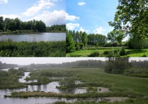
 CSS PNR Scarpe-Escaut, France
Conclusions and recommendations (see report for more details)
The IMAGINE project implemented an operational framework that allowed us to replicate in 5 countries and 6 case study cases similar analysis regarding both ecological multifunctionalities, societal demands and regulations, resulting in the capacity to define flexible models that can be adapted to the different contexts and stakeholders demands. There is a series of short take home message for each topic we addressed in the project.
species connectivity at the landscape level:
- When assessing the relationship between species and their environment, it is crucial that the input data correctly cover the ecological requirements of the species studied (necessary for modelling ecological niches).
- Bias in species observation data (localised over-observations for reasons of ease) must be taken into account when using data stored in open-access species databases (notably from citizen science).
- The generation of pseudo-occurrences (observation simulation) based on the species suitability of different habitats is an efficient approach to analyse potential corridors of species mobility at landscape level.
- Highlighting key cores and nodes enables managers and policymakers to target biodiversity management and conservation actions within territories.
ecosystem services and ecosystem Disservices:
- The capacity matrix approach is a flexible and efficient method for estimating capacity in ecosystem services and Disservices, as well as for engaging with local stakeholders and experts.
- Green and Blue Frame habitats provide 1.5 to 2 times more ES than non-GI habitats.
- Small GI linear elements are particularly important to ensure both the conservation of biodiversity and important ecological functions and services in agricultural landscapes (hedges, meadow strips, etc.).
- Wildlife connectivity and the capacity of ecosystem services are associated and not antagonistic. No trade-offs are needed between these two functions of the GI. It is therefore possible to promote both biodiversity and societal benefits.
- BTV elements provide ecosystem services associated with certain wild species with negative impacts (Disservices, crop predators, disease vectors, attacks, etc.). They need to be taken into account in management options. However, GIs provide many more services than Disservices.
Managing and restoring GI elements and networks:
- We have developed a hierarchical process to assess the management needs within each green infrastructure parcel.
- We have set up a system of “management blocks” that can be used to meet these needs and improve the quality of the green infrastructure plots to a level that allows for the required multifunctionality.
- Vulnerability analyses (a cartographic analysis that highlights the degree of vulnerability of natural habitats) allow us to identify the elements of green infrastructure that are particularly under pressure and thus help to prioritise management actions at the landscape level.
How can (existing) regulation mechanisms be further developed/improved?
- The broad and inclusive definition of green infrastructure leaves a lot of freedom and complexity in its management. There is no common understanding of what is a GI at the local level, despite EU and National definitions.
- Several different perceptions and preferences regarding ESs provided by green infrastructures may prevail. It is therefore important to define and specify the respective objective(s) for which a green infrastructure is implemented. This will help to manage the green infrastructures in the context of the different needs of society.
- A wide range of actors from different sectors are involved and have different interests regarding green infrastructures, which can lead to friction.
- The management and governance of green infrastructures is complex and requires participatory cooperation between institutions and stakeholders.
- Starting from common values related to the social elements and functions of green infrastructures will help to resolve frictions. For those elements and functions where opinions differ, it is important to understand why the opinions are contradictory. For the disadvantages brought about by green infrastructures, it is important to find ways to address them in integrated management.
Diverging, and conflicting societal demands:
- Local population and the citizens of neighbouring urban areas clearly prefer biodiversity conservation actions to agricultural intensification.
- Our results do not show a division of the population, i.e. farmers versus conservationists, but rather a huge overlap of preferences on this issue. Considering the different regional histories, contexts and policy mixes in the three countries, it is also surprising that the main conclusion is valid for all three case studies.
- From a policy perspective, our findings add to the broader and controversial discussion on the revision of the EU’s Common Agricultural Policy (CAP). The results clearly show that society supports the fact that biodiversity should play a (more) important role in agricultural production.
- Our analysis leads us to conclude that future decisions should rather focus on overcoming current obstacles on how to better integrate biodiversity conservation into current agricultural production systems. In addition to the strong preference for biodiversity conservation, our study shows that there is a common understanding of the problem.
Integrated modelling of GI multifunctionality as decision-support tools:
- The design of common Core Set activities (harmonised set of indicators) for all study sites has made it possible to integrate site-specific characteristics into a common framework for the ecosystem services supply chain.
- The use of an integrated and interdisciplinary approach is essential to support the exploration of barriers, trade-offs and opportunities for the design and management of green infrastructure in diverse urban and rural landscapes.
- The tools developed capture the knowledge of experts and local people and provide geographical visualisations, such as information on the qualities of local landscapes providing ecosystem services, thus stimulating stakeholder and public engagement.
- Visual representations and scenarios have the power to cut through the complexity and vagueness often associated with policy or planning alternatives.
- Two models have been implemented in the project. On the one hand a BBN (Bayesian Belief Network) and on the other the ConSite multi-criteria model, useful for both land use/zoning planning, ecosystem-based management, area/green accounts and nature conservation and restoration objectives.